
Hurricane Isaias Makes Landfall on U.S. Gulf Coast
Powerful storm brings dangerous surge, heavy rain, and wind damage to Alabama and the Florida Panhandle
PENN Explainer
Hear this story explained in 90 seconds.
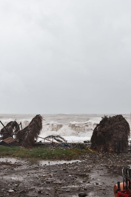
Hurricane Isaias struck the United States Gulf Coast on Friday as a Category 2 storm, bringing significant wind, rain, and flooding to the region. The storm made landfall near Destin, Florida, after intensifying over the warm waters of the Gulf of Mexico. National Hurricane Center Director Michael Brennan noted that the system posed a serious threat to coastal and inland communities alike. Residents across the Florida Panhandle, Alabama, and Mississippi were urged to take immediate precautions as conditions deteriorated throughout the day.
Forecasters warned of a life-threatening storm surge that could reach heights of up to nine feet in specific coastal areas. The combination of high tides and the storm's push of water threatened to inundate normally dry land from the Alabama-Florida border to Grayton Beach. Officials emphasized that the surge represented one of the most dangerous aspects of the weather event. Emergency management teams remained on high alert to assist those in low-lying zones.
Beyond the coast, the storm's impact was expected to spread well inland. Hurricane-force winds were projected to travel up to 100 miles from the shoreline, potentially affecting areas as far as metro Atlanta and parts of Tennessee. These winds raised concerns about widespread power outages and significant tree damage across the region. Local utility companies prepared for potential service disruptions as the storm moved north.
Heavy rainfall remained a primary concern for the weekend, with forecasts predicting four to eight inches of accumulation in many areas. This volume of water could trigger flash flooding, particularly in regions already saturated by previous weather patterns. The National Hurricane Center indicated that the rain would continue to impact the Southeast before moving toward the Midwest and Northeast by early next week. Residents were advised to monitor local weather alerts for changing conditions.
Florida Governor Ron DeSantis urged citizens to prepare for the aftermath of the storm, including potential shortages at gas stations and extended power outages. He stressed the difficulty of navigating rising water and encouraged those in evacuation zones to follow the guidance of local officials. The governor noted that the situation required residents to remain vigilant even as the storm began to weaken after landfall. Safety remained the top priority for state and local emergency responders.
As the storm moved inland, it was expected to lose strength and be downgraded to a tropical storm by Saturday afternoon. Despite this weakening, the threat of heavy rain and localized flooding was forecast to persist through the weekend. Meteorologists continued to track the system's path to provide updated information to the public. The transition from a hurricane to a tropical storm does not eliminate the risks associated with the system's moisture and wind.
This event marks the first hurricane of the 2026 Atlantic season to impact the eastern United States. The storm's arrival follows a period of preparation by local governments and emergency services across the Gulf Coast. Officials have spent the preceding days coordinating resources and communicating safety protocols to the public. The focus now shifts to damage assessment and recovery efforts in the hardest-hit areas.
Communities in the path of the storm have been encouraged to stay off the roads to allow emergency vehicles to operate safely. Local authorities are working to clear debris and restore essential services as quickly as possible. The full extent of the infrastructure damage will likely become clearer in the coming days as teams gain access to affected neighborhoods. Residents are reminded to avoid downed power lines and standing water.
Public safety agencies are currently managing the immediate response to the storm's impact. This includes search and rescue operations where necessary and the establishment of temporary shelters for those displaced by flooding. Coordination between state and federal agencies is ongoing to ensure that aid reaches the most vulnerable populations. The recovery process is expected to be a long-term effort for many of the impacted towns.
As the weather system continues its track, the focus remains on the potential for secondary hazards like tornadoes and mudslides. The National Hurricane Center continues to issue regular updates to keep the public informed of the storm's trajectory. While the immediate danger of the hurricane's core may pass, the secondary effects of the storm will require continued caution. Authorities will provide further guidance as the situation evolves over the next several days.
Ask the Author
Subscribers can ask the journalist a question about this story. Subscribe to ask.
Nota neutralitatis
Auto-harvested from global news wires and presented neutrally by PENN.
to vote
Comments
No comments yet — be the first to share your thoughts.